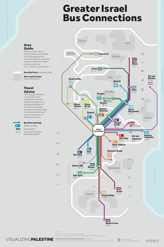
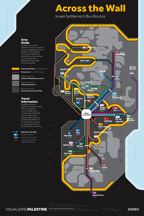
The two maps presented here offer subtly different representations of the same set of Israeli public transport data, collected from bus.co.il. Both plot the same Israeli bus routes as they travel to, or via, the same illegal settlements in the Palestinian West Bank.
Across the Wall explicitly illustrates the bus routes in the light of the growing annexation of Area C of the West Bank, and how the network allows Israelis to travel freely across the Separation Wall purportedly built to "protect" them from Palestinians. Meanwhile, Greater Israel Bus Connections shifts the focus to reflect the Israeli settler`s experience of the West Bank (here named "Judea and Samaria") as an indivisible part of "Greater Israel," its Palestinian inhabitants reduced to anonymity in the "restricted" Area A enclaves.
Conspicuously absent from both maps is the Palestinian experience of public transportation within the West Bank, where hundreds of checkpoints and other obstacles subject Palestinians to delays, detours and arbitrary closures. The bus networks that previously connected Palestinian towns and cities to East Jerusalem are now all but severed.

